3D Reality Modeling
Reality, Captured in Life-like Detail
Drone-based 3D models, point clouds, orthophotos, and support for client-provided LiDAR data, built for visualization, measurement, and documentation.
Capabilities
From Flight Plan to Finished Model
We handle FAA-licensed capture flights, photogrammetric processing, client-provided LiDAR data, and delivery in the formats your project needs.
Drone SfM 3D Modeling
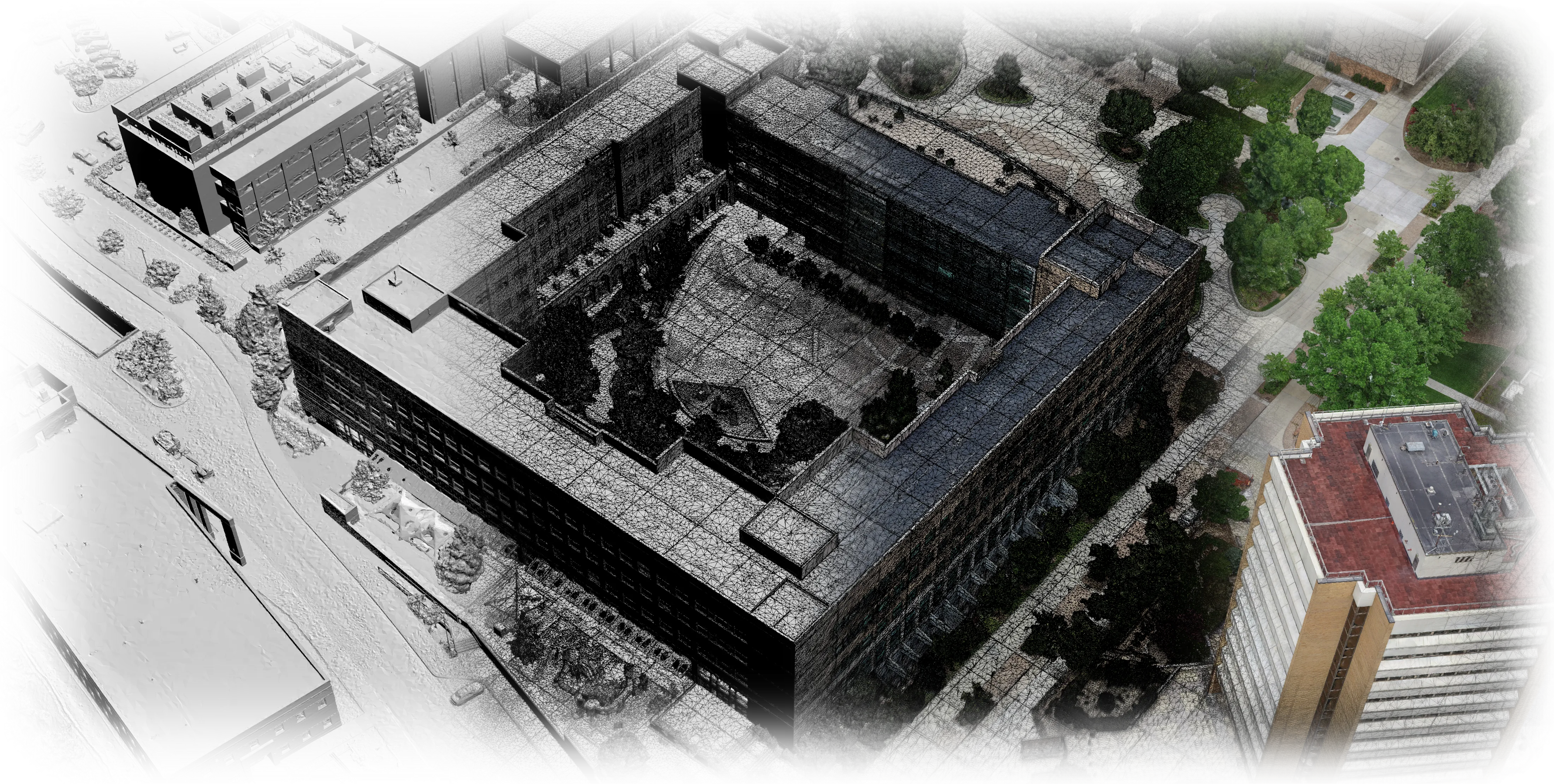
Structure-from-Motion photogrammetry converts hundreds of drone photos into photorealistic, measurable 3D models of real sites.
Orthophotos & Mapping
High-resolution, top-down orthomosaic maps of your site, far sharper and more current than satellite imagery.
Point Clouds, Meshes & LiDAR Data
Dense photogrammetry point clouds, client-provided LiDAR datasets, and textured meshes ready for visualization, analysis, and delivery workflows.
Visualization & Planning
Explore designs in context: before/after comparisons, planning views, and models your whole team can navigate.
Engineering & Cultural Heritage
Ultra-detailed reality capture for engineering documentation and the preservation of culturally significant sites.
Before & After Comparisons
Video and model comparisons that document progress on construction and landscaping projects over time.
Construction & Landscaping
See the Site Before You Break Ground
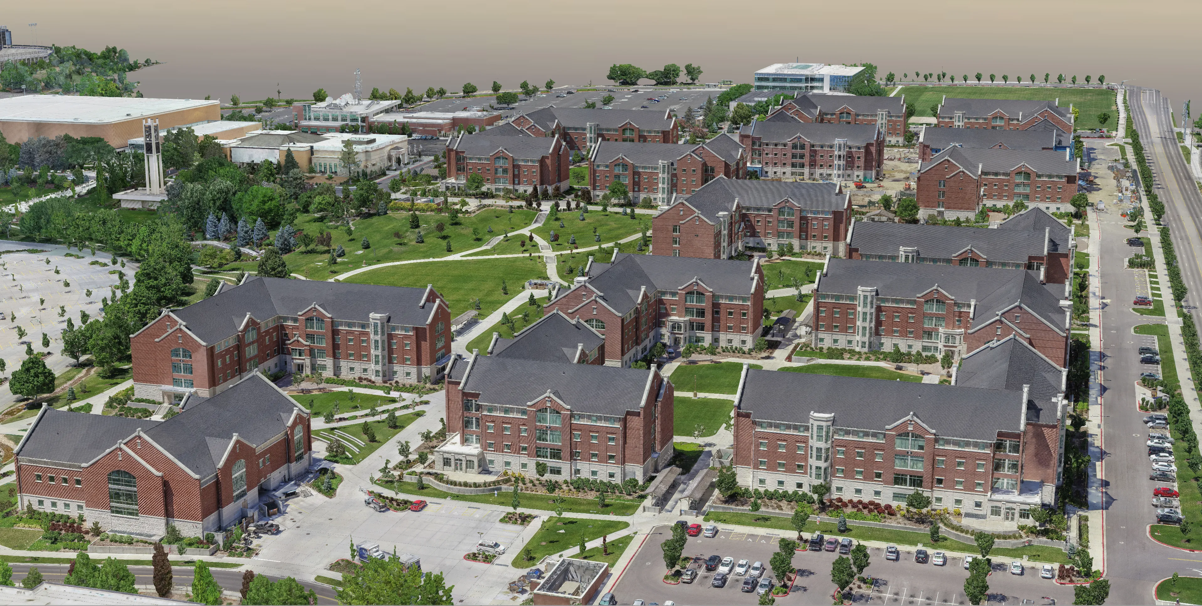
Textured 3D models, point clouds, and orthophotos give contractors and landscapers a shared, accurate picture for planning, client presentations, and progress documentation. The samples below come from several different client projects.
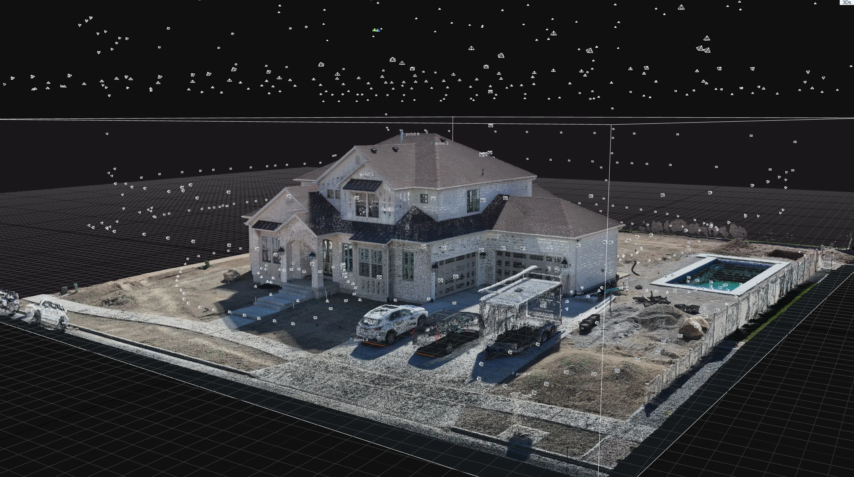
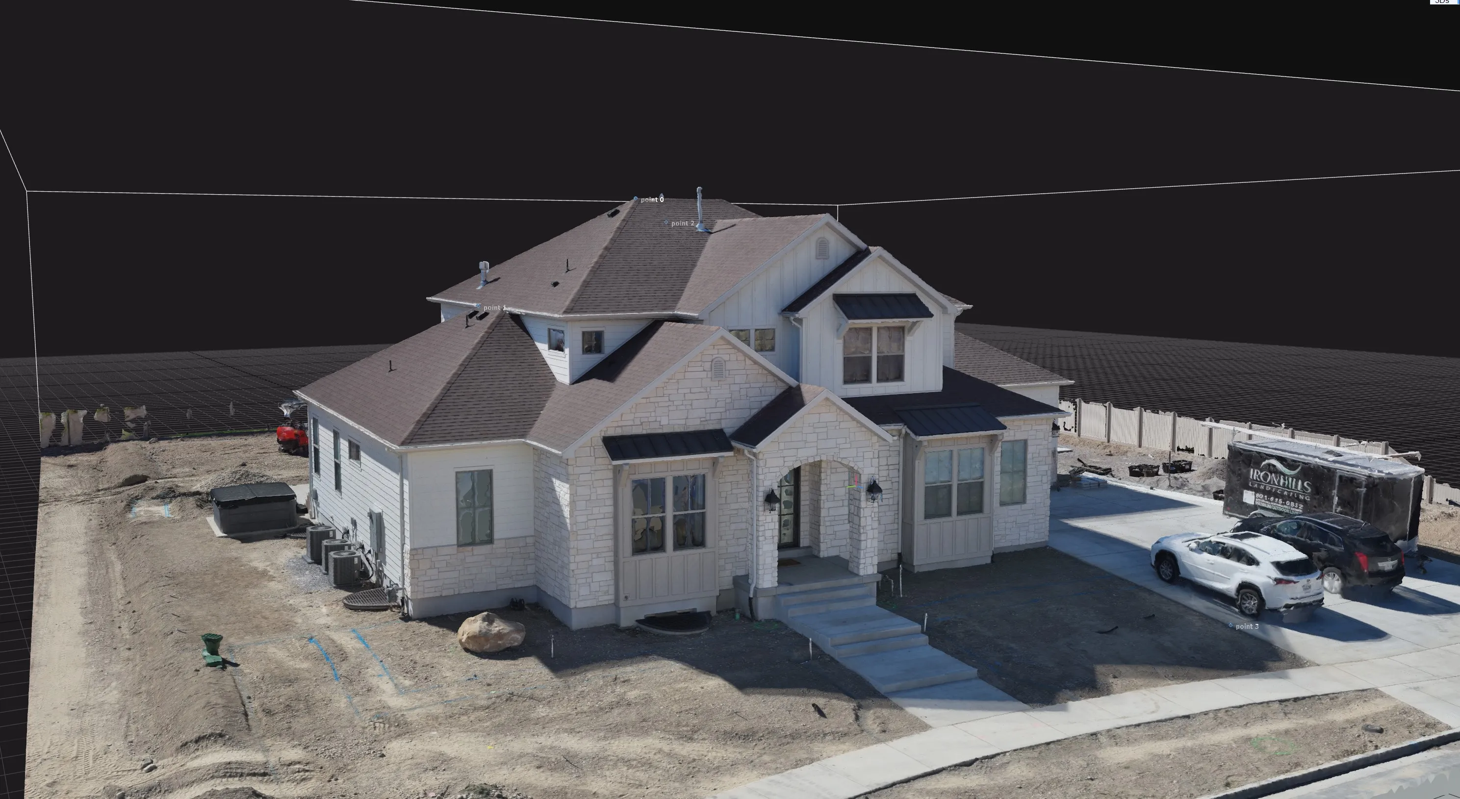
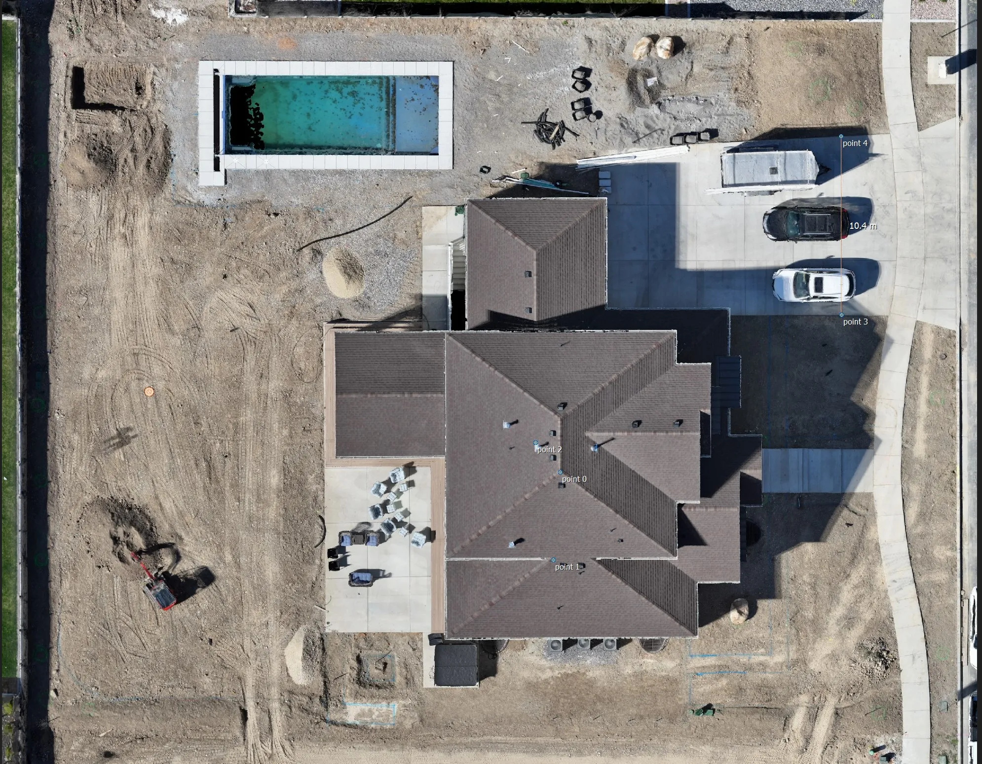
Before & after, documented from the air

3D Drone Model for Planning & Visualization
Measurement
Numbers Straight from the Model
A reality model is more than a picture. It's data you can measure directly on the mesh, without another site visit.
- Stockpile and cut/fill volume calculations
- Surface areas and distances on real terrain
- Repeatable measurements as your site changes over time
Planning-grade numbers, not a legal survey. When a project needs certified measurements, we work alongside licensed surveyors — see the disclaimer in the footer.
Flagship experience
The BYU 3D Digital Campus
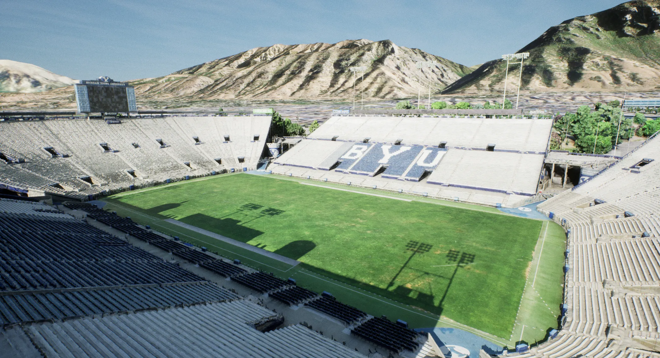
Before founding Altus Reality, founder Bryce Berrett led the creation of a photorealistic digital twin of Brigham Young University's entire campus as a graduate researcher. Built from more than 83,000 drone and ground photos, it was published academically and is still in use by the university today. That depth of experience is behind every capture we take on now.
- 83,000+
- drone & ground photos
- 75+
- campus buildings modeled
- 2021
- completed as university research
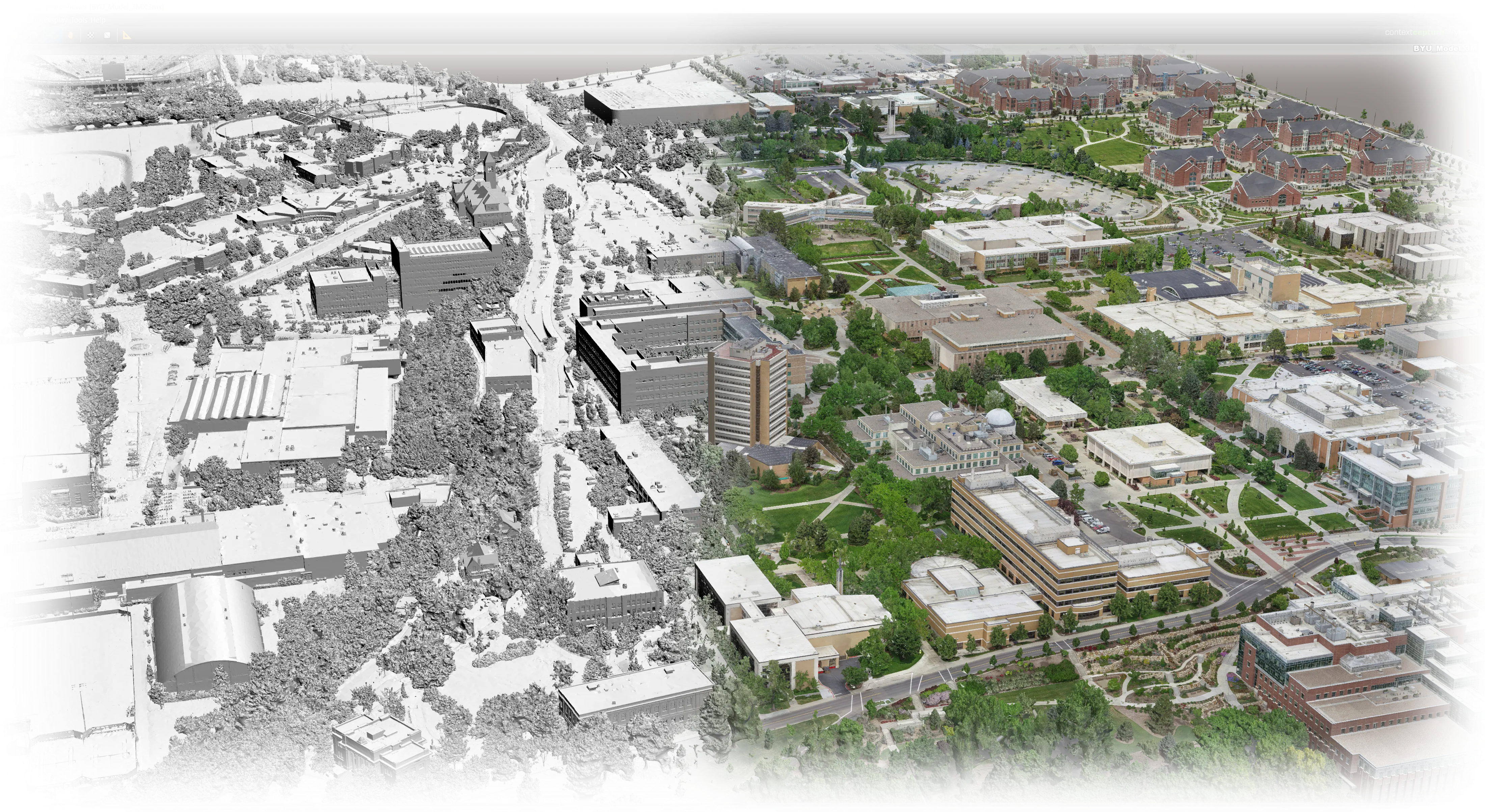

BYU 3D Digital Campus: Official Project Video
The finished BYU campus reality model, official project video
Beyond the model
Custom VR & Game-Engine Visualization
Captured models don't have to stay on a screen. We bring them into Unity and Unreal Engine for immersive VR walkthroughs, simulations, and interactive visualizations.
Have a Site to Capture?
Tell us about your project, and we'll recommend the right capture approach and give you a clear quote.
Get in touch